Monday, February 25, 2013

2/22/13-1/23/13: Apalachicola to Sarasota: Success But No Joy Ride: 210 NM


View My Route in a larger map

Wilson and I left out of Apalachicola Bay at 6:30 A.M. for our 210 mile journey to Sarasota.   There was dense fog in the area.  Government Pass was our passage into the Gulf.  We had anchored only a 1/2 mile from it.  The passage looked simple enough, IF THE BUOY MARKERS THAT MARK THE PASSAGE ARE PLACED IN THE RIGHT PLACE!!  Even being between the red and green buoys, I run aground in mud and stick the boat pretty good.  It takes me several minutes to get out of this one.

As I enter the Gulf and the surf and see the conditions I get a good shot of adrenaline.  It is nasty out there.  The seas are big with very steep and confused seas.  I am immediately getting jolted around and have to hold on tight to stay in the boat.  After 3 minutes of this I am considering turning back and waiting for better conditions.  But I motor on south.  The wind is in my face AGAIN and I can't use the sails.  A sailboat is much more steady and the motion better with the sails up.  They act as a wonderful stabilizer when sailing.  Without the sails flying the boat rolls and bucks and is very uncomfortable.

Wilson and I soon pick up a hitchhiker, Mr. Coldfront, who rides with us all the way to Sarasota.  He brought with him dense fog, rain, and lightning.  After a couple of hours of fighting the conditions I am wondering how my stamina is going to hold out.  I am cold, wet, and miserable.  There is no way I can tend to the boat constantly and physically hold up through the entire trip down.  So I devise steering solutions, or "rigs", to steer the boat as I take 15 second cat naps.  I start doing this 3 hours into the trip and continue through the trip.  So I would set my course, lay down in the cockpit under my wet blanket and put it over my head so I could try and remove myself from the elements surrounding me, and shut my eyes for a moment.  Under the blanket I would tell myself, "it will get better soon, just keep the boat moving".  It was a test of mind over matter.

It did get better 24 hours later.  I had faired the night OK and Sunday morning was looking good and stayed nice through to Sarasota.  As I said in an earlier post,  I am not fond of navigating an unfamiliar pass and anchoring at night.  My goal now was to get that done in the daylight.  When I got to Sarasota at 4:30 I was at the entrance to Big Sarasota Pass.  A dense fog reduced visibility to a 100 feet.  This was a tricky pass and I talked to a local to give me information.  He gave me GPS coordinates to get me through.  I plugged them in and made my move.  Soon I was aground and beached again.  I couldn't believe it.  The surf was pushing my boat farther onto the shoal.  I threw her in reverse and really screamed the engine and inched my way off of it.  I had bent my tiller shaft in the process and I feared the rudder might be damaged.

Below is an overhead shot of Big Sarasota Pass.  As you can see, trying to enter this in nothing but the best conditions is not advised.

View My Route in a larger map

I got back on the phone and asked for a better pass to enter.  It was going to be Longboat Pass and it was 8 miles away but I wasn't going to attempt that one again.  So, it was going to be another night entry.  It goes like this:  You are in unfamiliar waters and  can see practically nothing.  You are looking at your navigation screen and trying to put the triangle, your boat, in the right spot.  You do this while there are breakers crashing around you but you can't see them.  You move forward slowing watching your depth sounder, your nav screen, and try to spotlight some kind of marker with a spotlight outside.  To top it off, I don't see well at night.  It is very challenging for me and I have a lot to learn before I get it right.  I did make this one fine and got anchored at 8:30 pm.  It was a 38 hour passage.

Below is my Longboat Key anchorage.  It was very nice.

View My Route in a larger map

Friday, February 22, 2013

A quick recap of the city of Apalachicola


View My Route in a larger map


I thought the folks here were as nice a group of people as I have been around.  Like the lady at the courthouse said, "It's like a vacation for all of us here, everyday".  It shows too.  They pass that happiness right on to its visitors.  The history and architecture is worth the visit alone.  Walking the streets and browsing the shops is just FUN here.  You have the Gorrie Museum, the Raney House,  the Orman House, Richard Bickel's home, the Maritime Museum, etc, etc.  The seafood sure is good too.   The famous Boss Oyster house with their saying, "shut up and shuck".  But my favorite little spot was the Tap Room where the beers were good and I had the best fried oysters in town.  Yes, they were better than Boss's.   The town is clean.  They sweep the streetss.  I promise.  I saw them sweeping the streets with a hand broom.  It don't get no cleaner than that.  You can tell there is pride in this town.

Positioned for my run to Sarasota


I hated to leave my nice little slip in Apalachicola
I left Apalachicola and all it's very fine people, food, and history in a dense fog and rain and motored my way across the bay to a spot just off St. George Island near Governors Cut where I will enter the gulf tomorrow for my run to Sarasota.  Amazingly my Bitstorm Bad Boy Wi Fi "borrower" is "borrowing" wi fi out here.  Thus my ability to post.  WOW.  I love my Bad Boy!
Cheers from St. George Island
Just off St. George Island 

POSSIBLE BLACK OUT

I could possibly be out of posting range for up to a week or so.  I will not be in Sarasota long and plan to head south to the Dry Tortugas National Park for several days.  It is way out in the booneys.  Then make our way to Key West.  Hopefully I will have time to catch up on posting in Key West.

Thursday, February 21, 2013

Apalachicola: A Dying Bay

Apalachicola RiverKeeper Office  on Water Street


In a round about way I was introduced to a couple of the dedicated environmentalists working for the non profit organization The Apalachicola River Keeper.  We talked about the condition of Apalachicola River and Bay over a few beers and fresh snapper dinner.  To put it simply, the Apalachicola Bay is dying.  I not only heard this from the environmentalist, I overheard it from the cities residence with statements like "I can't find any oysters to buy in town", and saw it walking down Water Street in the idle oystermen.   The nutrients that nourish and produce one of the most productive estuaries in the world come from the Apalachicola River.  In the last decade the river's flow rate, measured in cubic feet per minute, have diminished due to climate changes and increased usage upstream.  The Apalachicola River Keeper organization is working to save the river.  Not just for the sake of the worlds finest oysters it produces, but for the tourist that eat them, the restauranteurs that serve them,  and the oyster men that still harvest them by hand using tongs, the last of oystermen to harvest oysters using this method.  But its a daunting task.  The Apalachicola River has a huge drainage basin consisting of around 19,000 square miles.  There are many entities that have interests in the river including industry, agriculture, and potable water supply systems.  Efforts of the Apalachicola River Keeper to coordinate a plan that balances the interests of the many users of the river is not an easy task. But they have made progress and from the energy I saw in these dedicated environmentalist, it will continue.  I wish them well.  This is certainly an environment worth saving.

Apalachicola Bay

Say Hello To My Little Friend

You know how moms are.  They worry no matter the age of their son or daughter.  My mom's concern about this cruise was her son's safety and well being.  So she thought long and hard to provide me with a gift that could be both companion and instrument of safety.

So say hello to my little friend Wilson.

Wilson
Wilson has become a steadfast, albeit somewhat quiet crew on the Mary Annie.  Nonetheless, he has become a valuable instrument of safety.  I like too keep things simple, and so does Wilson.  Most mariners have heard of the Beaufort Scale to gauge wind speed.  Well, to keep things simple, I have the Wilson Scale.  When things start to kick up a bit and it's time to make a sail change, I just take a quick peak at Wilson and he gives me the data I need.

When Wilson buries his head like an Ostrich, it's time to consider reefing the mainsail.
If Wilson is on the floor, the "shit is hitting the fan" so to speak
If Wilson is hiding under some clothes on the floor, well, we are both in our own "hell on earth" state.
Wilson came with his own "survival" kit.
The only problem Wilson has created thus far in our journey, and I am a little embarrassed to say, is that when my friends call me along the trip, they always ask how Wilson is doing instead of me.  That does create a bit of tension between us.

Cheers from the Mary Annie in Apalachicola Florida

Wednesday, February 20, 2013

2/17/13-2/22/13: Panama City to Apalachicola: 60 NM


View My Route in a larger map

I cruised the ICW today for the first time since leaving New Orleans.  It was a cool but nice day and the 54 mile cruise was nice and relaxing.  The only excitement for the day was motoring across Wimico Lake.  The channel is fairly narrow and I read there is no room for error.  The locals say if you get 6 inches out of the channel you will get stuck.  The navigation markers are far enough apart to make it interesting.
Cruising the ICW between Panama City and Apalachicola
Work boat


Dolphin far up the ICW


I keep a close eye on this screen
Apalachicola Marina...by chance found a gem....quiet, clean, and friendly and right next door to the oyster houses.
I motored into Apalachicola about 5:00 pm and started looking for my slip.  It couldn't have been a better fit for me.  I was soon tied up and heading for the shower and oyster house, the Tap Room, to celebrate.  The next couple of days were spent readying the boat for my first overnight passage and walking the town taking in the historic buildings and quaint shops.

The Tin Shed is worth a browse


Famous Boss Oyster House oysters

Sunday, February 17, 2013

2/12/13-2/16/13: Lake Pontchartrain to Panama City: 250 NM


View My Route in a larger map

On Tuesday February 12 I left Orleans Marina on the south shore of Lake Pontchartrain at 5 am to beat heavy weather coming in.  I decided to do the ICW instead of battle the Lake.

This is the draw bridge on the Industrial Canal that almost took my mast off on my way in to New Orleans.  If it hadn't have been low tide, it would have.


I had no trouble getting through the Industrial Canal and made my way west through the ICW in light rain.  It runs along the marshes of the Mississippi's alluvial plain.  It was nice.

Along the ICW leaving New Orleans


 My plan was to make Cat Island for the night.  It was ambitious.  I raised the sails as soon as I made the bay and make good time with a brisk wind on my tail.  The wind increased through the day and by the time I made Cat Island it was dark and blowing pretty hard.  I had a very hard time finding a place to drop the hook and eventually dropped it in 4 different places before exhaustion and sea sickness took over.  I found my bunk at 3:30 am.  I was in a nasty exposed spit of water in the middle of nowhere.  I rocked and rolled all night getting no sleep at all.  It was my very personal Hell on Earth kind of night.

The next morning I woke up to an all out gale.  I had to get up and get moving before I caught the full fury of the wind.  I double reefed my main before I weighed anchor and made 7 knots speed with double reefed main only.  It was hard to control the boat in the 6 ft. chop.  I was racing for the cover of Ship Island just a few miles away.  The wind smacked me all the way to the east side of Horn Island where I had had enough.  I dropped anchor around 3 pm in another bumpy spot and cleaned the boat.  It was a disaster.

Horn Island sunset
My waypoints along this section

I was headed to Perdido Pass which was 54 miles away, another long day.  The first half of the day was nice with moderate winds and I took some cat naps as the cape horn steered the boat.  Around noon the wind died and I motored the rest of the day.  Bro Pete texted that there was a crippled Carnival Cruise ship in the area.  I soon saw it being towed into Mobile Bay.
A tug pulling in the crippled Carnival Ship

I made Perdido Pass after dark and was trying to anchor just inside the pass.  I was inching forward in the dark and grounded the boat and was stuck.  I threw her in reverse and bulled my way out but stuck the stern, full throttle forward and a swing of the tiller got me out.  It was unnerving.  So I motored out onto the beach and decided to anchor right of the beach.  There was no wind but only a slight swell.  I was going to set two anchors and was moving forward slowly while hand feeding line out to my stern anchor.  Well, the line wrapped around my wrist and the anchor set and the anchor was pulling me overboard.  I unwrapped the line just before going over the lifelines.  This was becoming a fiasco.  So in a matter of one hour I ground the boat and lose and anchor.  One anchor will have to do.  I hit the bunk feeling pretty low.

The next morning a pod of dolphins swam right up the boat.  All swam off but one small one.  She stayed and did 6 jumps just feet from the boat.  She must have sensed my mood and did all she could to cheer me up.  It worked.  Soon after and found my floating anchor line from the lost anchor and retrieved it.  Things were looking up.  I was headed for Destin, FL 57 miles away.  Another long day.  I had good sailing for half a day and then had to motor from mid afternoon on.


The wind shifted, coming from my rear.  After nightfall the wind and waves really began to build.  Soon there were breaking waves chasing me down from behind.  It was a rush.  When I made East Pass in Destin I was in some really nasty seas.  I was exhausted and could not make out the way through the pass.  I was getting punchy.  I finally got on my radio and called out for assistance.  The Coast Guard responded and tried to talk me through the pass.  They soon realized I was toast and came out to escort me through the pass.  I was very grateful.  I would have beached the boat if they hadn't come out for me.  They stayed with me until I anchored in Destin Harbor and came up to the boat to ask where I came from.  I told them Little Rock and then they told me to get some sleep.  And I did the entire next day in Destin.

I left Destin February 17 heading for Panama City.  It was 48 miles away.  The wind died after 1 hour of sailing so I motor sailed the rest of the way making over 6 knots most of the way.  I was in St. Andrews Bay by 4 pm and had a nice walk on the beach before catching up on the journal.

Anchored at St. Andrew Bay, Panama City

Sunday, February 10, 2013

1/25/13-2/3/13: Little Rock, AR to Lake Ponchartrain, LA: 650 NM


View My Route in a larger map

It took 9 days to get from Little Rock to Lake Ponchartrain via the Arkansas and Mississippi Rivers.  It was approximately 630 river miles.  "Mary Annie" averaged around 5 mph on the Arkansas River and 11 mph on the Mississippi.  The Arkansas was "tame" compared to the Mississippi, which had strong currents, lots of debris, a lot of barge traffic, and wind and waves.  The Arkansas was relaxing and laid back.  The Mississippi was challenging.  There are two fuel options on the Miss. River, Greenville and Baton Rouge.
Murray Lock, Little Rock

Amy, my wonderful river runner and wife

Locking through


Arkansas River Sunset
The White meets the Mississippi

Concentrating on the Mississippi

Navigating through a fog bank

Darryl at the helm

Barge traffic on the Mississippi
Dodging debris on the Mississippi


Lower Mississippi River sunset


A tug against the atomic sky
Sunrise is even better than the sunset
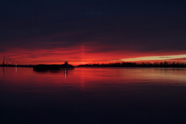
A barge works close to our boat against the blood red sky
Our first glimpse of New Orleans
Coast Guard boards Mary Annie in front of French Quarter
Caught at night in the Industrial Canal
We arrive at Orleans Marina after 14 hrs of motoring and 106 miles


Sailing Mary Annie for the first time on Lake Ponchartrain